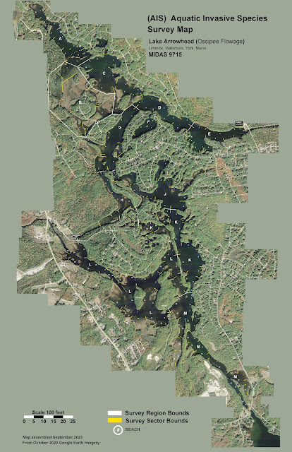
A friend has very kindly compiled some maps of Lake Arrowhead for the purpose of surveying for invasive plants. It divides the lake up into regions, and each region is broken into sectors with boundaries that are easily identified from the water. Regions are lettered from A through M (omitting O and I to avoid confusion with zero and one), and the sectors are numeric within each region.
Regions were defined so that, as much as possible, they represent a similar type of lake habitat.
The Lake Arrowhead Community beaches are also marked as well as known boat ramps.
In addition to an overview map showing the regions, map images have been produced for each region, so that when someone is patrolling a region they can have the region map with them.
Here are links to images of the individual regions:
D and F combined
Here is a pdf file of all the maps.
